It is not everyday that I awaken to the radio telling me that Civil Defense has been activated due to the imminent arrival of a Tsunami.
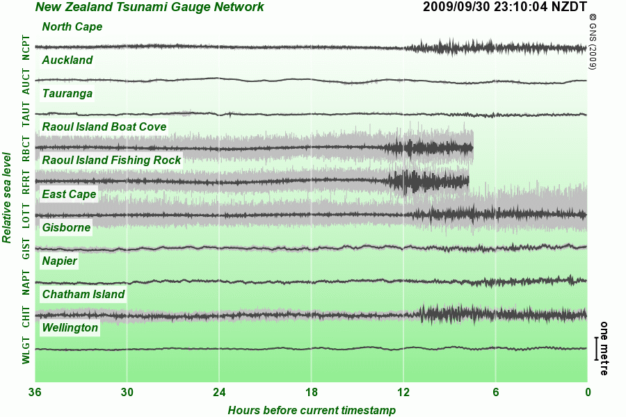
Luckily the effects of the Tsunami on New Zealand were slight to non-existent, but not totally unnoticed. The following chart is from the excellent GeoNet web site. GeoNet (amongst other things) maintains a system of tsunami gauges around the country for just this sort of event.

The graph on the GeoNet site is a moving window so I have copied a static version here. I took graph snapshot at about 11pm, you can clearly see the waves hit different parts of the country in succession start from about 9:30am at Raoul Island (I didn't know where it was either). Luckily for us there was nothing over a metre.
Samoa was not so fortunate as we were in NZ, with many fatalities in low lying areas despite a very speedy evacuation.